Aerial Land Photography – Phetchaburi
- Location
- Phetchaburi Province
- Type of job
- Aerial land photography and video
- Deliverables
- High-resolution stills (raw files) and aerial video
- Shot in
- September 2026
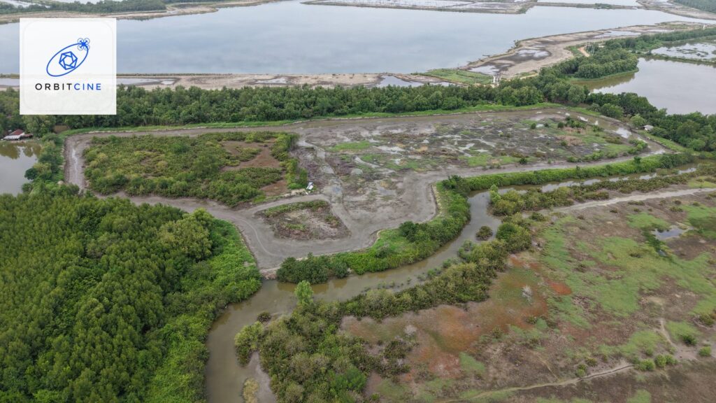
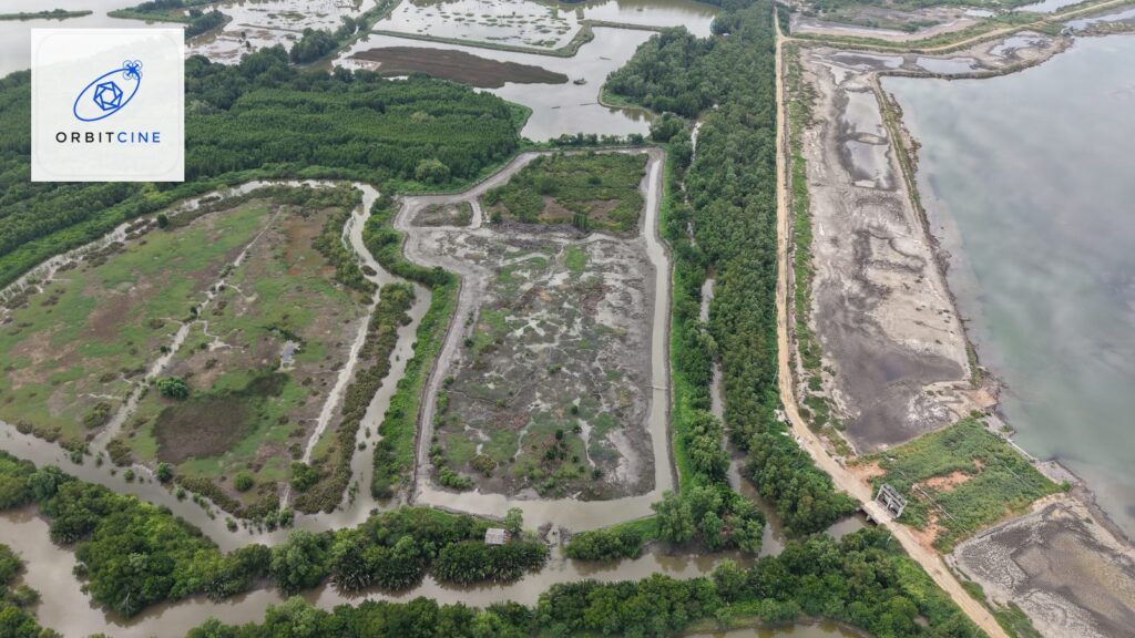
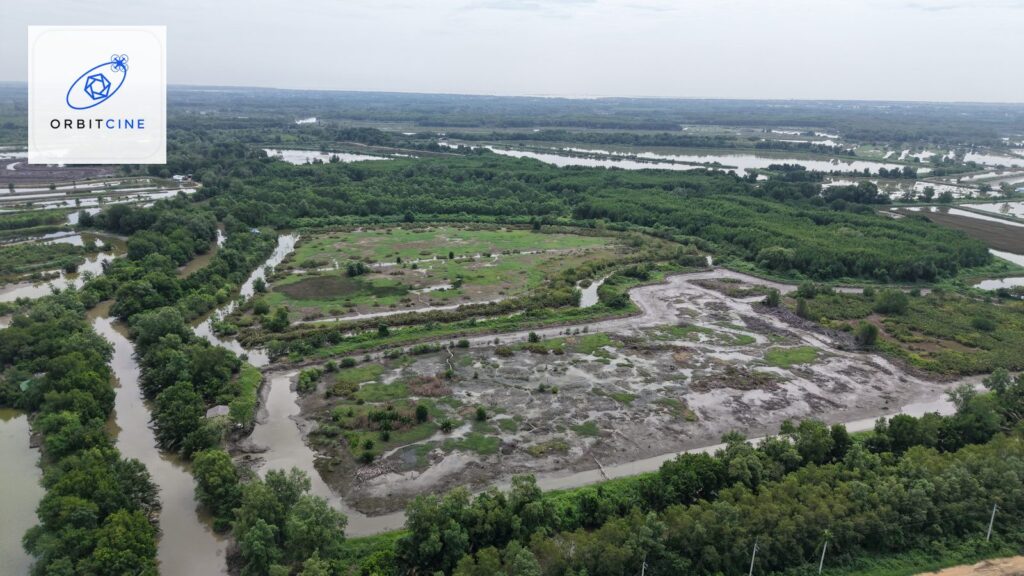
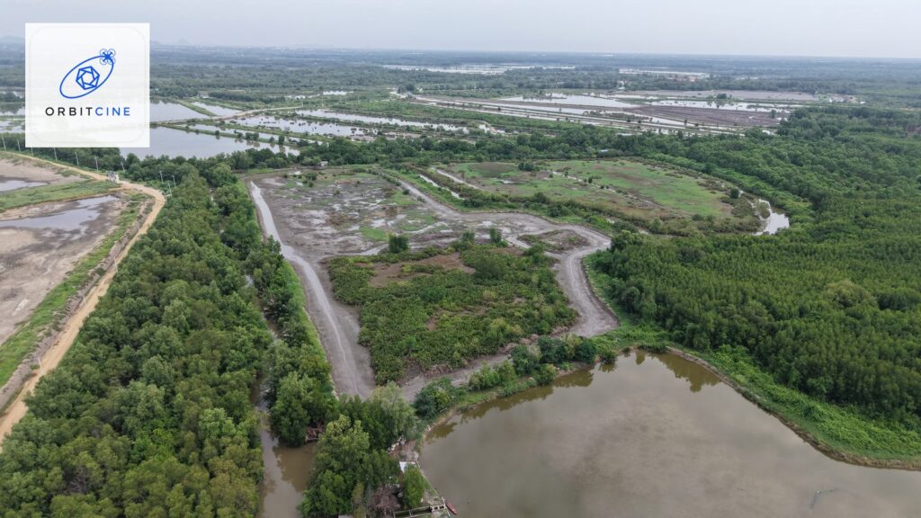
Job Aerial land photography in Phetchaburi Province. The landowner wanted to see the entire plot in one image — its shape, boundaries, access and the surrounding area — something ground-level photos can't do. Our pilots planned the flight, checked no-fly zones before going to site, then captured high-resolution stills and aerial video as agreed with the client. For this job the client chose to receive full-resolution raw files to use themselves.
The brief from Phetchaburi
Large plots of land share one limitation: wherever you stand, you can't see all of it. Eye-level photos show roughly what the land looks like, but not how the plot is laid out, which side faces the road, or where the tree lines and water are. Landowners who need to share information with others — for review, for sale or for planning how to use the land — need an image that shows the whole plot in one frame.
The brief was straightforward: usable images, no gimmicks, no 3D model — just full-resolution raw files for the client to use as they wished.
Our aerial land photography steps before take-off
- Check no-fly zones before going to site On every job we check the coordinates against the announcements of the Civil Aviation Authority of Thailand (CAAT) and the distance from airports in advance — not when we arrive.
- Plan the shooting time Morning and late-afternoon light give the terrain very different depth. We choose the time when boundaries and surfaces show most clearly.
- Define the required set of angles Top-down shots to show the shape of the plot, oblique shots to show the surroundings, and wide shots to show context with roads and neighboring land.
- Licensed pilots Our team flies within the rules — altitude limits, visual line of sight, and permission wherever it's required.
Deliverables
- High-resolution stills as uncompressed raw files, ready for cropping and editing.
- Aerial video of the plot, showing the overall picture and the surrounding area.
- All files have embedded location data removed before delivery, in line with our data security standards.
Why aerial images change the game for land
A single aerial image answers questions that would take ten sentences to explain. Viewers instantly see where the plot is, what it borders and how big it is compared with its surroundings. For anyone who has to share land information with another party, aerial images cut down repeat site visits and make conversations far quicker.
Read more about drone photography for real estate, homes and land or see the drone no-fly zone map by province to check your area before booking.
Frequently asked questions
How long does an aerial land shoot take?
The flying itself usually takes a few tens of minutes per plot, but total time on site depends on the area, the number of angles and the weather on the day. We always assess it before accepting the job.
Do you take jobs in other provinces?
Yes, nationwide — this project itself was in Phetchaburi. Message us on LINE with the province and what the land is like, and we'll tell you whether we can fly and whether extra permission is needed.
Do I really get raw files, or only compressed ones?
You get full-resolution raw files as agreed. On this job the client asked only for raw files and no 3D model, so that's exactly what we delivered.
Can you fly if the land is near an airport or a military area?
We need to check the exact coordinates first. Some areas can't be flown at all; others can, but need advance permission and come with altitude limits. Send us the coordinates or the subdistrict name and we'll check for free.
How safe is my land information?
We never publish title deeds, precise plot locations or landowners' names in public media. Projects we showcase are identified only at province level, and every file has its location data removed before use.
Want aerial images like these?
Message us on LINE with the area and type of job. We'll first assess whether we can fly and what permissions are needed, then send a quote.